Construction
The use of drones on construction sites has been steadily increasing in recent years due to the ability to cut down on construction costs. Drones offer a continuing ability to monitor progress and increase safety.
Pre-bid job site inspections are significantly less money and a much quicker turn around time.
According to Jeff Link of Autodesk, surveying a site with drones provides a time-saving of nearly 75 percent. According to Price Waterhouse Coopers, threatening accidents on construction sites monitored by drones decreased by up to 91 percent.
Drones cut down on surveying inspection costs by focusing surveyors on areas of concern at the construction site.
The use of UAV’s in construction has been shown to decrease overall costs 15%-40% over the life of the project by keeping up better with site inspection and asset management.
Inspections
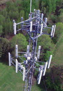
We offer a variety of inspection services, from insurance damage and roofing inspection to cell towers and solar panels. We can minimize your costs by saving time and money as well as offering customize reports and images for your specific needs in a fraction of time from current methods.

Real Estate
The increasing value of drones in real estate has been well documented over the past few years. With the ability of 3D modeling and Virtual Reality tours, you can offer more options to clients in a fraction of the time. The use of these tools helps to increase Realtor closing percentages by giving the client a sneak preview of the property. On higher profile homes where the current homeowner requests privacy, you’re able to get a firm appointment without needless interruptions to homeowner.
3D Modeling
Reel High Media can create 3D models of whatever you need, be it residential buildings, commercial property, or any outdoor structure.
360 Panorama
We can create 360 degree panoramas which can be viewed on screen or in fully immersive virtual reality.
Agricultural Image Analysis
Through the use of UAVs, growers can identify areas of plant stress, detect symptoms of pests infestation or nutrient application issues. Identified issues can be quickly shared via mobile tools with agronomists and field staff to diagnose and treat each problem.
Our UAVs are operated by certified UAV pilots and flights are conducted on-demand as growers desire. Image analysis tools transform aerial imagery into actionable data, allowing growers to detect and treat early-onset crop issues, resulting in long-term savings and improved crop health.

